
File:Batum Treaty.svg

此SVG文件的PNG预览的大小:512 × 352像素。 其他分辨率:320 × 220像素 | 640 × 440像素 | 1,024 × 704像素 | 1,280 × 880像素 | 2,560 × 1,760像素。
原始文件 (SVG文件,尺寸为512 × 352像素,文件大小:876 KB)

摘要
| 描述 |
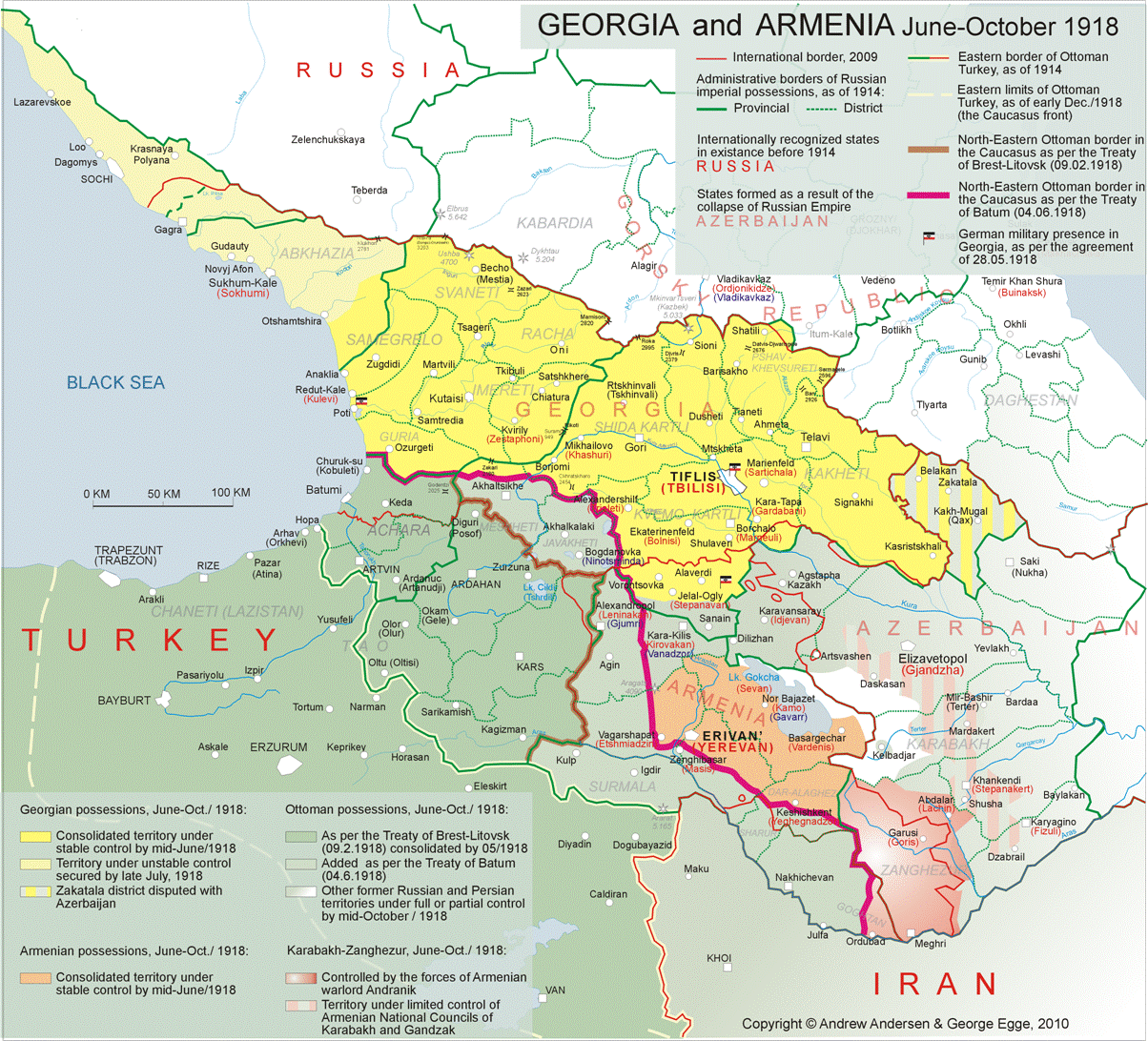
English: The treaty of Batum signed by the Caucasus states. Original can be found File:Treaty_of_Batum.png here, and also updated with minor changes taken from [this] |
| 日期 | |
| 来源 | 自己的作品 |
| 作者 | Peachy1621 |
许可协议
我,本作品著作权人,特此采用以下许可协议发表本作品:
| 本作品采用知识共享CC0 1.0 通用公有领域贡献许可协议授权。 | |
| 采用本宣告发表本作品的人,已在法律允许的范围内,通过在全世界放弃其对本作品拥有的著作权法规定的所有权利(包括所有相关权利),将本作品贡献至公有领域。您可以复制、修改、传播和表演本作品,将其用于商业目的,无需要求授权。
|
文件历史
点击某个日期/时间查看对应时刻的文件。
| 日期/时间 | 缩略图 | 大小 | 用户 | 备注 | |
|---|---|---|---|---|---|
| 当前 | 2025年3月8日 (六) 23:03 | | 512 × 352(876 KB) | Peachy1621 | Some updates |
| 2025年2月20日 (四) 17:46 |  | 512 × 352(918 KB) | Peachy1621 | Nakhijevan was declared as under the RSFSR's suzerainty by Andranik, not an SSR* | |
| 2025年1月22日 (三) 20:47 |  | 512 × 352(901 KB) | Peachy1621 | Zagatala borders changed (used to be included within Georgia) to a neutral dashed line. Red army dark red outline fixed, and Ejmiatsin adjusted. Shushi Council updated as well with a dashed line for a border. | |
| 2025年1月8日 (三) 07:32 |  | 512 × 352(897 KB) | Peachy1621 | Added the Armenian Nakhijevan SSR (declared by Andranik Ozanian in mid-1918) and fixed Zagatala, as the borders near Georgia and Azerbaijan were doing some weird z-fighting of some sort. | |
| 2025年1月8日 (三) 05:41 |  | 512 × 352(835 KB) | Peachy1621 | Color of the lakes and rivers changed to match the coast. | |
| 2024年9月25日 (三) 22:29 |  | 512 × 352(770 KB) | Peachy1621 | {{Information |Description= |Source= |Date= |Author= |Permission= |other_versions= }} | |
| 2024年9月25日 (三) 22:20 |  | 512 × 352(778 KB) | Peachy1621 | Map fixed (borders were adjusted, and some stuff reinstated and renamed.) | |
| 2024年6月4日 (二) 02:52 |  | 512 × 352(736 KB) | Peachy1621 | Uploaded own work with UploadWizard |
文件用途
以下页面使用本文件:
全域文件用途
以下其他wiki使用此文件:
- en.wikipedia.org上的用途
- fa.wikipedia.org上的用途
- tr.wikipedia.org上的用途