
File:Papua New Guinea location map.svg

此SVG文件的PNG预览的大小:800 × 481像素。 其他分辨率:320 × 192像素 | 640 × 385像素 | 1,024 × 615像素 | 1,280 × 769像素 | 2,560 × 1,538像素 | 2,280 × 1,370像素。
原始文件 (SVG文件,尺寸为2,280 × 1,370像素,文件大小:501 KB)
摘要
| 描述 |
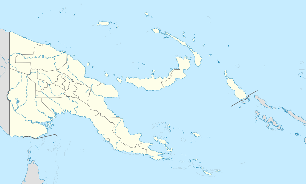
Deutsch: Positionskarte von Papua-Neuguinea
Quadratische Plattkarte. Geographische Begrenzung der Karte:
English: Location map of Papua New Guinea
Equirectangular projection. Geographic limits of the map:
|
| 日期 | 05-09-2008 |
| 来源 |
own work, using
|
| 作者 | NordNordWest |
| 其他版本 |
|


|
|
许可协议
我,本作品著作权人,特此采用以下许可协议发表本作品:

|
已授权您依据自由软件基金会发行的无固定段落及封面封底文字(Invariant Sections, Front-Cover Texts, and Back-Cover Texts)的GNU自由文件许可协议1.2版或任意后续版本的条款,复制、传播和/或修改本文件。该协议的副本请见“GNU Free Documentation License”。 |
本文件采用知识共享署名-相同方式共享 3.0 未本地化版本许可协议授权。
- 您可以自由地:
- 共享 – 复制、发行并传播本作品
- 修改 – 改编作品
- 惟须遵守下列条件:
- 署名 – 您必须对作品进行署名,提供授权条款的链接,并说明是否对原始内容进行了更改。您可以用任何合理的方式来署名,但不得以任何方式表明许可人认可您或您的使用。
- 相同方式共享 – 如果您再混合、转换或者基于本作品进行创作,您必须以与原先许可协议相同或相兼容的许可协议分发您贡献的作品。
您可以选择您需要的许可协议。
文件历史
点击某个日期/时间查看对应时刻的文件。
| 日期/时间 | 缩略图 | 大小 | 用户 | 备注 | |
|---|---|---|---|---|---|
| 当前 | 2012年6月5日 (二) 15:48 | | 2,280 × 1,370(501 KB) | NordNordWest | upd |
| 2011年5月26日 (四) 07:49 |  | 2,280 × 1,370(767 KB) | NordNordWest | Reverted to version as of 19:42, 8 December 2009 no need to revert | |
| 2011年5月25日 (三) 23:00 |  | 2,280 × 1,370(674 KB) | AlexR.L. | Reverted to version as of 19:51, 5 September 2008 | |
| 2009年12月8日 (二) 19:42 |  | 2,280 × 1,370(767 KB) | NordNordWest | + rivers | |
| 2008年9月5日 (五) 19:51 |  | 2,280 × 1,370(674 KB) | NordNordWest | {{Information |Description= {{de|Positionskarte von Papua-Neuguinea}} Quadratische Plattkarte. Geographische Begrenzung der Karte: * N: 0.6° S * S: 12.2° S * W: 140.4° O * O: 159.7° O {{en|Location map of [[:en:Papua New Guinea |
文件用途
以下42个页面使用本文件:
- 1970年新几内亚岛地震
- 2010年新不列颠岛地震
- 2016年國際足協U-20女子世界盃
- 2016年大洋洲國家盃
- 2018年新不列颠岛地震
- 2018年新几内亚岛地震
- 丘阿韋縣
- 加泽尔半岛
- 卡維恩
- 基埃塔
- 基永加機場
- 塔里
- 布卡 (巴布亚新几内亚)
- 布卡機場
- 布因 (巴布亚新几内亚)
- 布納 (巴布亞新畿內亞)
- 戈伊拉拉縣
- 戈羅卡
- 戈羅卡機場
- 拉包爾
- 新爱尔兰岛
- 日魯阿機場
- 格尼機場
- 欽布機場
- 波尔盖拉
- 潘古纳
- 瓦巴格
- 科科波
- 芒特哈根
- 莫尔斯比港
- 莱城 (巴布亚新几内亚)
- 辛邦
- 達魯
- 達魯機場
- 門迪 (巴布亞紐幾內亞)
- 阿拉瓦 (巴布亚新几内亚)
- 霍斯金斯機場
- 韋瓦克機場
- 韦瓦克
- 马当
- Template:Location map Papua New Guinea
- Draft:博拉姆机场
全域文件用途
以下其他wiki使用此文件:
- af.wikipedia.org上的用途
- als.wikipedia.org上的用途
- Vorlage:Positionskarte Papua-Neuguinea
- Port Moresby
- Bismarck-Archipel
- Neubritannien
- Duke-of-York-Inseln
- Admiralitäts-Inseln
- D’Entrecasteaux-Inseln
- Lavongai
- Westliche Inseln
- Feni-Inseln
- Lihir-Inseln
- Tabar-Inseln
- Tanga-Inseln
- St.-Matthias-Inseln
- Vitu-Inseln
- Neuirland
- Louisiade-Archipel
- Marshall-Bennett-Inseln
- Woodlark-Insel
- Trobriand-Inseln
- Mount Wilhelm
- an.wikipedia.org上的用途
- ar.wikipedia.org上的用途
- ast.wikipedia.org上的用途
- Puertu Moresbi
- Nueva Bretaña
- Montes Herzog
- Archipiélagu Bismarck
- Islles del Duque de York
- Tabubil
- Islla Daru
- Estrechu de Dampier
- Islles del Almirantalgu
- Monte Lamington
- Archipiélagu de les Lluisiaes
- Aeropuertu Internacional de Jacksons
- Aeropuertu de Guasopa
- Puertu de Dreger
- Módulu:Mapa de llocalización/datos/Papúa Nueva Guinea
- Módulu:Mapa de llocalización/datos/Papúa Nueva Guinea/usu
- Islles d'Entrecasteaux
- Provincia de Nueva Bretaña Occidental
- Islles Trobriand
- Kitava
- Vakuta
查看此文件的更多全域用途。