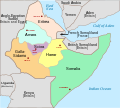
File:Italian East Africa (1938–1941).svg
外观

此SVG文件的PNG预览的大小:668 × 599像素。 其他分辨率:268 × 240像素 | 535 × 480像素 | 856 × 768像素 | 1,141 × 1,024像素 | 2,283 × 2,048像素 | 1,012 × 908像素。
原始文件 (SVG文件,尺寸为1,012 × 908像素,文件大小:147 KB)
文件历史
点击某个日期/时间查看对应时刻的文件。
| 日期/时间 | 缩略图 | 大小 | 用户 | 备注 | |
|---|---|---|---|---|---|
| 当前 | 2025年2月16日 (日) 07:22 |  | 1,012 × 908(147 KB) | Supaplex | File uploaded using svgtranslate tool (https://svgtranslate.toolforge.org/). Added translation for zh-cn. |
| 2025年2月16日 (日) 07:12 |  | 1,012 × 908(131 KB) | Supaplex | File uploaded using svgtranslate tool (https://svgtranslate.toolforge.org/). Added translation for zh-tw. | |
| 2024年9月11日 (三) 12:30 |  | 1,012 × 908(115 KB) | Andrei Stroe | File uploaded using svgtranslate tool (https://svgtranslate.toolforge.org/). Added translation for ro. | |
| 2024年7月24日 (三) 13:59 |  | 1,012 × 908(100 KB) | 123taro | File uploaded using svgtranslate tool (https://svgtranslate.toolforge.org/). Added translation for ja. | |
| 2023年12月27日 (三) 01:02 |  | 1,012 × 908(90 KB) | 123taro | File uploaded using svgtranslate tool (https://svgtranslate.toolforge.org/). Added translation for ja. | |
| 2023年10月5日 (四) 08:50 |  | 1,012 × 908(84 KB) | Amortres | File uploaded using svgtranslate tool (https://svgtranslate.toolforge.org/). Added translation for ca. | |
| 2023年10月5日 (四) 08:47 |  | 1,012 × 908(84 KB) | Amortres | File uploaded using svgtranslate tool (https://svgtranslate.toolforge.org/). Added translation for ca. | |
| 2018年8月16日 (四) 19:58 |  | 1,012 × 908(73 KB) | Hohum | Better focus on subject, cartographic colours | |
| 2008年11月16日 (日) 20:39 |  | 1,012 × 908(74 KB) | Themightyquill | ||
| 2008年11月14日 (五) 17:47 |  | 1,012 × 908(75 KB) | Themightyquill |
文件用途
以下2个页面使用本文件:
全域文件用途
以下其他wiki使用此文件:
- azb.wikipedia.org上的用途
- bg.wikipedia.org上的用途
- bs.wikipedia.org上的用途
- ca.wikipedia.org上的用途
- da.wikipedia.org上的用途
- de.wikipedia.org上的用途
- en.wikipedia.org上的用途
- Italian East Africa
- Second Italo-Ethiopian War
- Gideon Force
- East African campaign (World War II)
- List of national border changes (1914–present)
- Battle of Keren
- Italian invasion of British Somaliland
- Governorates of Italian East Africa
- Harar Governorate
- Amhara Governorate
- Galla-Sidamo Governorate
- Somalia Governorate
- Italians of Ethiopia
- Southern Rhodesia in World War II
- Scioa Governorate
- Northern front, East Africa, 1940
- User talk:Isayas Legese
- List of governors of the governorates of Italian East Africa
- 23 Field Regiment (India)
- Territorial evolution of Ethiopia
- User:Falcaorib/Italy
- en.wikibooks.org上的用途
- es.wikipedia.org上的用途
- et.wikipedia.org上的用途
- eu.wikipedia.org上的用途
- fa.wikipedia.org上的用途
- fi.wikipedia.org上的用途
- he.wikipedia.org上的用途
- incubator.wikimedia.org上的用途
- it.wikipedia.org上的用途
- ja.wikipedia.org上的用途
查看此文件的更多全域用途。


